The dry prairies of Southeast Oregon have been the backdrop for land disputes for centuries — long before armed men decided to set up shop in Malheur National Wildlife Refuge, demanding land sovereignty and snacks.
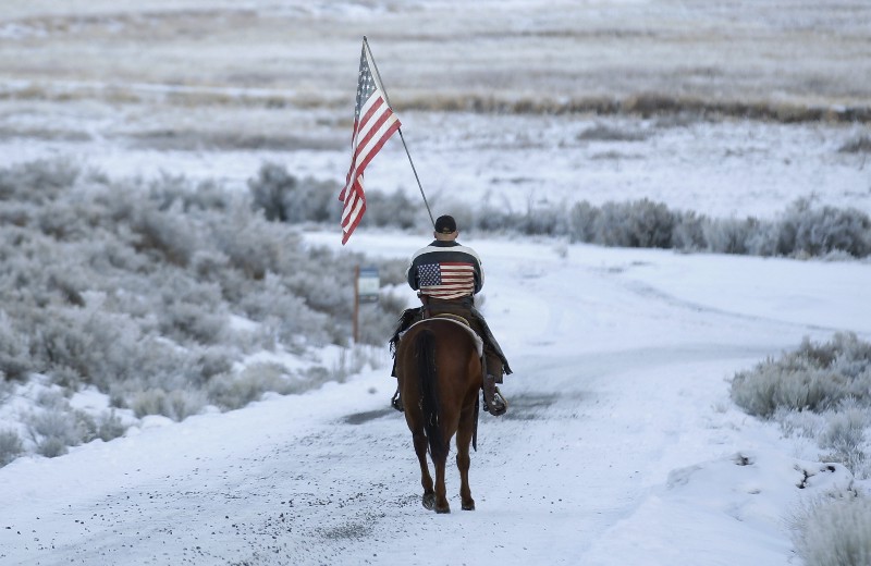
Anti-government militiamen have occupied the refuge’s headquarters since last week in response to sentences leveled against two local ranchers, Dwight and Steven Hammond, for intentionally setting fires on federal land. Led by the sons of Cliven Bundy, a Nevada rancher with a history of federal standoffs, the group occupying the refuge is also calling for a broader federal surrender of land they believe belongs to ranchers.

But the dramatic move, which claims to protect ranchers’ livelihoods, actually threatens the fragile ecosystem of a community that has been working to carefully balance the competing interests in the land. And the people of Harney County have grown weary of the fighting.
“Let’s just knock this crap off and go back to being friends and neighbors,” resident Jesse Svejcar told a crowded room of locals last Wednesday night at a meeting in nearby Burns, Oregon, where residents vented frustrations about the standoff.
Local residents are tired of the ongoing game of tug-of-war over the land now referred to as the Harney Basin. This latest dispute has rekindled the tensions over land use that have marked the region ever since cattle barons first settled on Paiute Indian soil in the mid-1800s.
Just a few years ago, however, stakeholders including ranchers, environmentalists, and federal agents unveiled an agreed-upon conservation plan for the wildlife refuge sitting in the heart of the basin. It had taken three years to negotiate, but the result — which took into consideration ranchers’ livelihoods, ecological concerns, and local economic sustainability — became a beacon of hope in the region, as well as in other rural communities wrought with similar conflict.
Now, Ammon Bundy’s headline-grabbing occupation is imperiling that accord.
A Short History of Deep-Seated Conflict
The Great Basin is a high-desert region of 200,000 square miles between the Sierra Nevadas in California and the greater Rocky Mountains in Utah, running from southern Oregon all the way to northern Baja, Mexico. Water is fickle and scarce in this area of the country, rendering the landscape fragile and throwing communal usage and management issues into far starker relief than most westerners face. That makes the type of collaboration that the Theodore Roosevelt Conservation Partnership’s (TRCP) Joel Webster tries to engineer between naturalists and businessmen much harder.
“It’s the driest place in North America, or one of them. It’s an ecosystem on edge. There’s not a lot of grass to share like there is in north-central Montana, where the grass grows up to your thighs,” Webster, who runs the Partnership’s Center for Western Lands in Missoula, said in an interview. “So you’ve got all the different stakeholder groups, and the pie is a lot smaller. That’s where some of this conflict comes from.”
And like many contentious land battles, it goes back decades.

Malheur Lake and the surrounding wetlands have belonged to the United States Fish and Wildlife Service (FWS) since the turn of the century, when it was dubbed a national wildlife refuge by President Theodore Roosevelt. Its first few decades were focused on creating a healthy sanctuary for the native birds the refuge was created to protect. But not long after, crippling drought sparked the beginning of ongoing land disputes, both inside the courtroom and out. These battles expanded and contracted the boundary of the fragile refuge for years.
Then came the floods. The winters of the early 1980s saw record-breaking snowfall in the nearby Steens mountain range and smaller peaks bordering the valley. Come spring, the snowmelt pushed the brimming Malheur Lake to a tipping point — which resulted in valleywide flooding. Despite hasty attempts to build a dike, 30 ranches flooded, putting ranchers and their families out of work and, for some, out of a home.
Hank Vogler, a Harney County native, was one of those ranchers.
“Everything I had was destroyed,” said Vogler, who moved his sheep farm to Nevada after the flood, in hopes of starting anew.
Many Harney ranchers, including Vogler, saw this as an intentional move by the government to stealthily force ranchers into selling their land.
Vogler said that federal foresight could have deterred this devastating flood. Distributing water from the lake in anticipation of heavy flooding could have saved these ranches, he said. “They were just sitting on the water, not doing anything with it,” Vogler said. “The federal government had no federal authority over the water — but they used it to harm our land.”
Everything I had was destroyed
Nancy Langston, an environmental historian and author of Where Land and Water Meet: A Western Landscape Transformed, spent years piecing together the way water rights shaped the area. The idea of federal scheming to buy out lands is “laughable,” she said in an interview.
“The refuge didn’t have the kind of technology to do anything like that, or the motivation,” she said. “They knew lake levels vary enormously, and they were as prepared as they could be. But it was a natural flood.”
An Army Corps of Engineers report from a few years earlier shows that the corps actually considered multiple plans to divert the lake’s water — but found the possible solutions far too expensive to go forward with.
Some of those most affected by the flood, like Vogler, gave up and moved away to greener pastures. Fred Otley and his family, on the other hand, stuck it out.
“Our family’s always committed that we’re going to be here one way or the other. We’re going to find a way for win-win solutions on the land no matter who else screws up the process,” Otley, whose grandfather first homesteaded along the lake in 1886, said from the headquarters of their 18,000-acre spread in Diamond, OR. “We’re not going anywhere. We will survive and find a way to turn negatives into positives.”
According to Vogler, a close friend of the Hammond family, the Hammonds did the same, but with perhaps more clandestine — and possibly illegal — techniques.
Vogler said he was with Dwight Hammond when they stumbled upon a source of water running down the Steens mountains directly into the refuge land. The Hammond’s alfalfa field was in dire need of water, and Vogler suggested he divert some of the water to his property. It was only a matter of time until the FWS noticed a change in the refuge’s water levels. Once they flagged Hammond as the mastermind behind the diversion, he couldn’t seem to get off the feds’ radar.
“That was the beginning of the end for the Hammonds,” Vogler said.
From Chaos To Cooperation
In the following decades, tensions grew. Environmentalists wanted to protect the salmon in the basin’s watershed by labeling them an endangered species, which meant taking back huge portions of rancher land along the rivers. Ranchers continued to fight the government for water rights. Government workers — which made up 32 percent of the county — needed reliable paychecks. The Paiute Indians needed the government to protect the ancient grounds promised to them. The Malheur refuge needed to keep its diverse bird population safe.
By 2010, these conflicting interests had reached a breaking point. Stakeholders set aside their grudges to move toward finding a solution.
Ranchers, tribal members, conservation groups, community business owners, and state and federal agencies joined together to hash out an official conservation plan that would consider all parties’ needs. After three years of work, the refuge adopted a 779-page long-term management plan.
In parts, it reads like an international peace treaty: “Collaboration with our neighbors, partners, and friends will be a critical cornerstone in our day to day work; we recognize that nature crosses our boundaries and we can be successful only in partnership. We recognize that our activities are inextricably linked to the health of the local economy…We commit to learn from our efforts, successes, and failures; to be humble about what we know.”
The Hammonds’ story is not the history we need to celebrate
As part of the plan, Harney County ranchers signed a 30-year-agreement with the government promising to protect the native, endangered sage grouse on their land — a first in the nation. The entire project was dubbed one of the “biggest wetland restoration efforts ever undertaken.”
Suddenly, ranchers were letting conservation scientists onto their land to advise them on how to care for the habitat of the wildlife that shared their private land. The long-standing bitterness had quelled through collaboration, rather than armed standoffs.
“The vast majority of wildlife in the country is not on public lands, and that isn’t going to change. So it’s crucial small refuges like Malheur work close with their local community,” Langston said.
“That’s what makes this recent standoff even sadder to me,” she said. “Malheur had done more work to listen and help its community than any other federal refuge out there. They all really wanted to make this happen. And then this.”
Collaborative planning processes like the one in the Harney Basin are the essence of good land management, said the TRCP’s Webster.
“We try to sit down with people and develop a shared vision early on in the process, or at least make sure our vision isn’t stepping on theirs. You do it in a way that minimizes conflict,” Webster, who runs the group’s Western Lands Project, said in an interview. Sitting down face-to-face is essential. “Meet with folks, get to know them, go to the public meetings, be a part of the community. It makes you more aware and sympathetic of their issues, and them of yours.”
False Nostalgia
Despite vast private holdings, the Otley ranch’s economic survival depends utterly on access to water on public lands owned by the U.S. Bureau of Land Management (BLM) in the high desert.
“BLM lands are critical for spring and summer, and refuge lands are critical for our winter use,” Fred Otley said. “It’s different ecological and plant communities, elevations that grow different things that are good for different seasons of the year.”
That means the Otleys’ business practices on public lands are subject to the public interest in maintaining taxpayer lands. The ranchers purchase grazing and water access — the same kind of fees Cliven Bundy has refused to pay for years — that shifts around geographically to prevent overgrazing of any one area.
But some landowners aren’t so amenable to that kind of collaboration with the agencies that represent the rest of us. They seek what’s called state sovereignty over public lands: a transfer of rulemaking and administrative authority over taxpayer property from federal agencies to state and county authorities.
The relative dryness in the Great Basin, and the subsequent higher tensions over water, make the region encompassing Nevada, Utah, and southeast Oregon something of a hotbed for state sovereignty, compared to the rest of the west.
Moderates like Otley see a synergy between agricultural profit-making and ecologically sound management practices. “Our business is built on properly managing wildlife habitat, watersheds, and soil resources,” Otley said. “When we’re wrong, we pay the bill. I just think that in some circles, they think that because we’re a private business it’s gotta be a conflict with good biological management.”
But mining is different, and the same state sovereignty Otley favors for ranchers would open the door to businesses that permanently alter the landscape.
“People who understand policy and budgets know that this is a crackpot idea that will never work, and actually would serve against the interests of the agriculture community,” the TRCP’s Webster said.
Nonetheless, the movement to seize land management decisions away from centralized agencies is growing. Webster attributes that shift partly to a sense of false nostalgia.
“A lot of radicals who are speaking up against public lands are just outright opposed to any government whatsoever,” Webster said. He added there appears to be a misconception that if these lands were handed over to the state, it would force a return to idealized version of the lawless west, when ranchers hired people with guns to prevent other people from grazing the land they wanted to graze.

The Bundys Stoke The Flames
The perception of injustice in the Hammond case is shrinking the gap between radicals like the Bundys and moderates like Otley. Ultimately, normally consensus-minded people could be driven into the arms of the radical Bundys. Instead of a fringe notion — “the end of the bell curve” of the western community, in Webster’s words — their desire to wrest management authority away from the public’s representatives at BLM and FWS could become mainstream.
And nobody knows better than long-time residents of Harney County how a trickle can become a flood.
“While I don’t entirely support what Mr. Bundy is doing, I cannot think of a better way to draw people’s attention to this crisis right now. We’ve tried a lot of things. They haven’t worked,” Vogler, who testified in the Hammond trial and believes the men were framed by FWS, said.
Webster understands the ranchers’ upset, but doesn’t see the Bundys’ approach as a solution.
“It clearly seems unreasonable to put somebody in prison for five years for burning 139 acres of public land. There are some legitimate frustrations out there like that,” Webster said. “But we have a system of laws put in place for reasons. You get engaged if you don’t like the laws to try and change them. You don’t hold a standoff.”
Ironically, this is the exact type of engagement that had been set in motion by Harney County residents prior to the recent shake-up from the Bundys’ Nevada clan. At this point, it’s hard to tell what kind of impact the refuge standoff will have on the freshly-healed partnerships between ranchers and the federal workers in the community. Author Langston said she’s frustrated by the coverage the Hammond case has been getting, especially since it taints the story of reconciliation the region’s seen in recent years.
“The Hammonds’ story is not the history we need to celebrate,” Langston said. “We have this pretty incredible piece of work that brought the community together, and took years to create. That’s the story that no one wants to hear.”