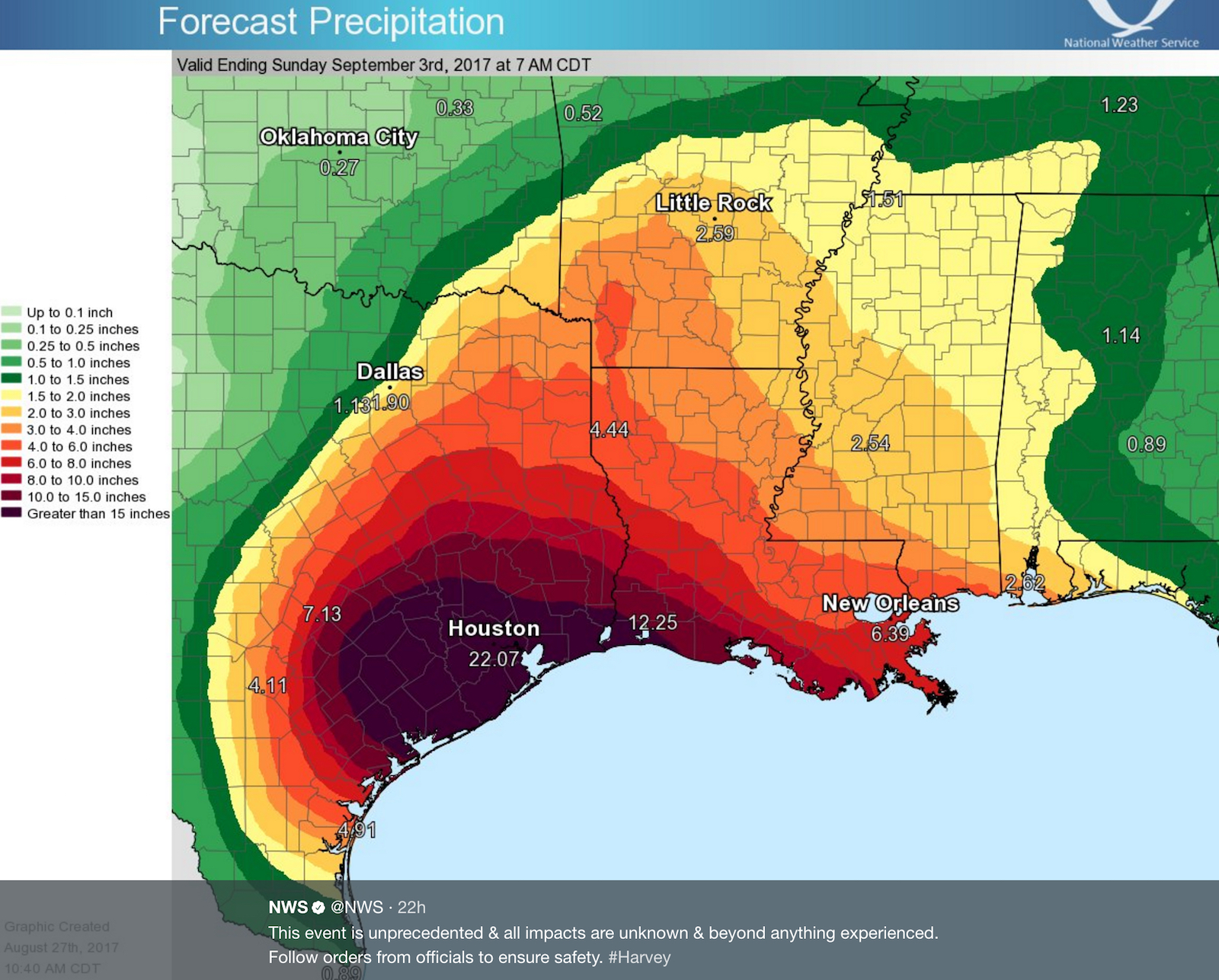
The flooding over Houston has become absolutely devastating, and now it is officially record-breaking. Parts of Southeast Texas have now seen 50 inches of rain since Friday — and the rain is still falling.
“The record for total rainfall from a tropical system has been BROKEN!” the National Weather Service tweeted Tuesday morning. The previous record for wettest tropical system in the continental United States was 48 inches. Harvey had already hit 49.20, and the rain was still coming.

“Many textbooks have the 60-inch mark as a once-in-a-million-year recurrence interval,” as the Washington Post Weather Gang reported Sunday.
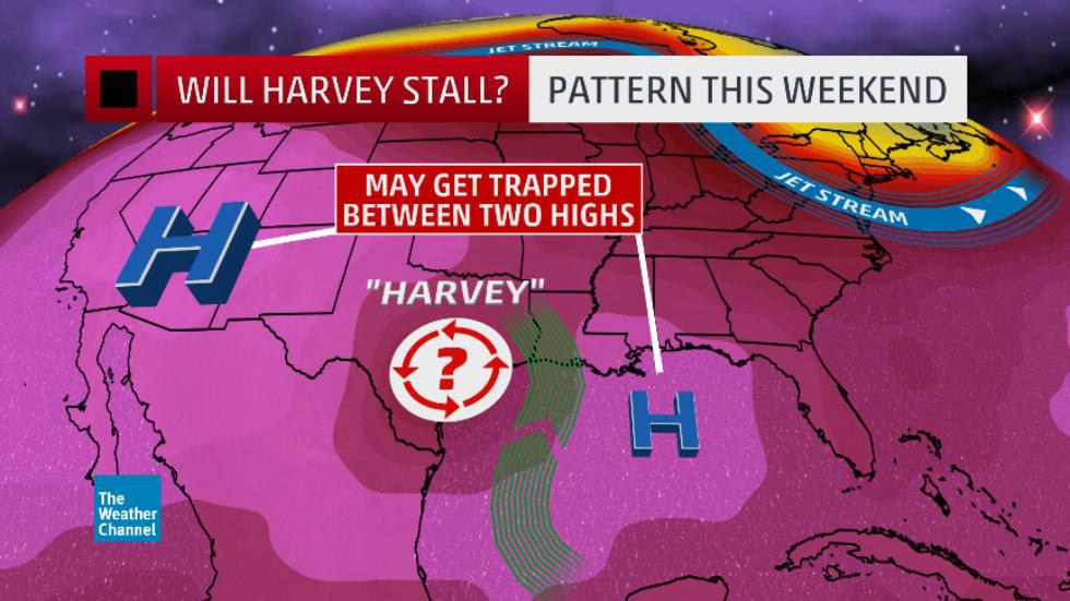
We’re seeing these staggering rainfall totals because this tropical storm hovered in place for days over southeast Texas, sweeping in vast quantities of moisture from the warm waters in the Gulf of Mexico. And the latest science points a finger at climate change for this.
“The kind of stalled weather pattern that is drenching Houston is precisely the sort of pattern we expect because of climate change,” climatologist Michael Mann explained in an email to ThinkProgress. Earlier this year, Mann co-authored a study explaining how human-caused warming is changing our atmosphere’s circulation, including the jet stream, in a way that leads to “increase in persistent weather extremes” during the summer.
“I agree with Mike [Mann] that the weak steering currents over the south-central US coincident with Harvey are consistent with our expectations for a warmer world, which of course includes effects of a very warm Arctic,” Jennifer Francis, a climate scientist at Rutgers University, told ThinkProgress.
Francis is a leading expert on how global warming and the related Arctic amplification affect the jet stream and extreme weather. A study she co-authored that appeared in the Journal of Climate in June, concludes, “Over the central United States during summer, the weaker and wavier flow” of the jet stream favors “more intense summer weather.”

Since we are seeing more and more of this type of devastating extreme events driven by stalled weather patterns, let’s briefly review the science.
A 2012 study led by the National Oceanic and Atmospheric Administration (NOAA), and coauthored by Francis, concluded global warming was driving changes in extreme weather in North America. “Our research reveals a change in the summer Arctic wind pattern over the past six years,” lead author James Overland of NOAA explained at the time. “This shift demonstrates a physical connection between reduced Arctic sea ice in the summer, loss of Greenland ice, and potentially, weather in North American and Europe.”
“Enhanced warming of the Arctic affects the jet stream by slowing its west-to-east winds and by promoting larger north-south meanders in the flow,” NOAA said in a press release. “The researchers say that with more solar energy going into the Arctic Ocean because of lost ice, there is reason to expect more extreme weather events, such as heavy snowfall, heat waves, and flooding in North America and Europe but these will vary in location, intensity, and timescales.”
A 2015 study by Francis and Stephen Vavrus, “Evidence for a wavier jet stream in response to rapid Arctic warming” concluded that global warming was driving an increase in the most extreme events because of “more frequent high-amplitude (wavy) jet-stream configurations that favor persistent weather patterns.”
Francis explained her findings in this video:
The path of the jet stream “typically has a meandering shape, and these meanders themselves propagate east, at lower speeds than that of the actual wind within the flow. Each large meander, or wave, within the jet stream is known as a Rossby wave.”
A 2014 study from the Potsdam Institute for Climate Impact Research (PIK) further explained that we’re seeing “an exceptional number” of extreme North American weather in recent years because some Rossby waves are stalling out for extended periods of time: “the study shows that in periods with extreme weather, some of these waves become virtually stalled and greatly amplified.”
Of course, the interactions between global warming and Northern Hemisphere weather are complex. We still have much more to learn about “Recent Arctic amplification and extreme mid-latitude weather,” as made clear in a Nature Geoscience paper (with that title) written by several of the leading researchers in the field, including Francis.
The evidence is mounting that we have entered a new regime of prolonged record-smashing extreme weather events thanks to our as-yet unrestricted emissions of greenhouse gas. But, as Francis, told ThinkProgress, that doesn’t mean we can attribute the stalling of Harvey to climate change and “near-record-low ice conditions in the Arctic’s Pacific sector” with certainty.
“But the persistent pattern this summer of strong ridging in western North America — with a jet stream located far to the north — is expected to occur more often in the future,” said Francis. “We can say the pattern existing a present fits with expectations, but the finger of blame cannot (yet!) be pointed confidently at climate change in general or the Arctic in particular.”
Bottom line: Superstorm Harvey is what climate change looks like–and we’re on track to see many more Harveys in the future. In the meantime, Houston and the surrounding areas will struggle to protect themselves from this out-sized disaster.


